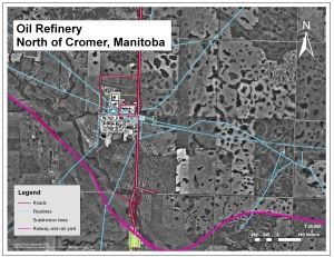
Oil Refinery North of Cromer, Manitoba
(Click on the map for a full-size version, or on the link above for a more detailed pdf.)
One of the main tasks for my summer job in 2009 was to update base maps for the Rural Municipality of Pipestone, just south of Virden, Manitoba. Virden is known as the “Oil Capital of Manitoba”, with new oil reserves continually being discovered (www.virden.ca), and so drawing each and every pipeline in the area, especially near this oil refinery, was a time-consuming process. The drawings were based on updated registered plans; learning how to read them was one of the summer’s biggest accomplishments. An orthophoto (an aerial photograph with coordinates) from the Manitoba Land Initiatives website was placed in the background to ensure that what I drew matched up with what was actually on the ground.
These drawings were done using ESRI’s ArcEditor software.

FYI, this facility is not a refinery. It is Enbridge Pipeline’s mainline terminal.
Thanks for setting me straight; I just drew it and never got to go there:)